
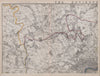


The Colne Valley, where the river runs towards the Thames through Hertfordshire and Buckinghamshire, forms the north-western edge of London's environs on Weller's antique maps. His Environs of London sheets for Cassell's Weekly Dispatch Atlas, published in 1862 and 1863, take in Uxbridge, Rickmansworth, Watford, Amersham and the Chalfonts, and a coloured north-west sheet of 1868 reaches St Albans and the Chilterns. A vintage relief and drainage map from the 1968 Atlas of London sets the Colne among the Thames tributaries with the Brent, the Lea and the Wey.
EU orders up to €150 are sent VAT- and duty-paid — no additional taxes on arrival
Authenticity Guaranteed - We only sell original antique & vintage items
Can we help? Call us on +44-208-960-3476 • FAQs
All our products are exempt from US tariffs — no additional duties or taxes payable on arrival.


- Shop by Country
- Shop by Cartographer
- Shop Maps by Type
- Shop Prints by Subject