
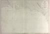

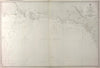

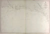
The Admiralty's Victorian charting of the south coast of British New Guinea runs from the Aird River to Freshwater Bay, taking in Deception Bay on the way. These antique sea charts of 1880 are Sheet 4 of the Papua or New Guinea series.
EU orders up to €150 are sent VAT- and duty-paid — no additional taxes on arrival
Authenticity Guaranteed - We only sell original antique & vintage items
Can we help? Call us on +44-208-960-3476 • FAQs
All our products are exempt from US tariffs — no additional duties or taxes payable on arrival.


- Shop by Country
- Shop by Cartographer
- Shop Maps by Type
- Shop Prints by Subject