


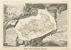


Mountain passes, glaciers and fortified valley towns fill these antique maps and views of the Hautes-Alpes, from departmental maps by Levasseur, Perrot, Tardieu and Vuillemin centred on Gap to detailed guidebook sheets of the Écrins, Pelvoux, Queyras and Briançonnais. Routes over Montgenèvre and the Lautaret lead from the Durance valley towards the Italian frontier, and a fishing map records the rivers and their species. The prints give these routes a human scale, with Bartlett's travellers, soldiers, goatherds and religious processions on bridges and steep approaches. Briançon's Pont d'Asfeld, Château-Queyras, Embrun and Dormillouse recur beside the Meije and the Glacier Blanc, and later landscapes show La Grave, Villar-d'Arène and the Clarée.
EU orders up to €150 are sent VAT- and duty-paid — no additional taxes on arrival
Authenticity Guaranteed - We only sell original antique & vintage items
Can we help? Call us on +44-208-960-3476 • FAQs
All our products are exempt from US tariffs — no additional duties or taxes payable on arrival.


- Shop by Country
- Shop by Cartographer
- Shop Maps by Type
- Shop Prints by Subject