
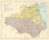


Post towns, market days and railway connections make Letts's Popular County Atlas a practical portrait of late Victorian England and Wales. Letts, Son & Co. published it in London in 1884, and its county sheets, among them Essex, Durham, Bedfordshire, Cheshire and Leicestershire, set each town within its roads, railways and administrative divisions for readers planning journeys or looking for local centres of trade. A general key map relates the separate sheets to the railway network, and the counties appear as they were before the local-government changes of the twentieth century.
EU orders up to €150 are sent VAT- and duty-paid — no additional taxes on arrival
Authenticity Guaranteed - We only sell original antique & vintage items
Can we help? Call us on +44-208-960-3476 • FAQs
All our products are exempt from US tariffs — no additional duties or taxes payable on arrival.


- Shop by Country
- Shop by Cartographer
- Shop Maps by Type
- Shop Prints by Subject