
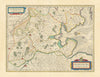


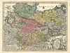


Hanoverian territories and North Sea islands give these maps of Lower Saxony a reach well beyond today's state boundaries. Earlier sheets by Seutter, Homann, Blaeu and others show the imperial Circle of Lower Saxony, which stretched farther east and north, and map historical regions such as Oldenburg, East Frisia, Calenberg and Grubenhagen. Town plans cover Hanover, Brunswick, Göttingen, Hildesheim and Osnabrück, some as pictorial maps seen from above, and Harz excursion maps contrast with charts of the Wadden and East Frisian islands. Geological surveys of the oilfields and wartime coastal sheets add specialist mapping, and the prints include early town images and views of castles and settlements.
EU orders up to €150 are sent VAT- and duty-paid — no additional taxes on arrival
Authenticity Guaranteed - We only sell original antique & vintage items
Can we help? Call us on +44-208-960-3476 • FAQs
All our products are exempt from US tariffs — no additional duties or taxes payable on arrival.


- Shop by Country
- Shop by Cartographer
- Shop Maps by Type
- Shop Prints by Subject