
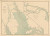


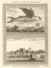


Macao, the coastal enclave at the mouth of the Pearl River, is mapped here among the river approaches to Canton and Hong Kong. Bellin's eighteenth-century plans and editions after Schley examine the town and port, Dennys's nineteenth-century mapping shows the harbour more closely, and later coastal charts and regional sheets set the peninsula among the foreign trading settlements of southern China. Naval intelligence mapping treats Hong Kong and Macao together in the mid-twentieth century. The prints show the landing place, the theatre and the rocky temple landscape, scenes near Liantang and the dramatic destruction of the Portuguese warship Donna Maria II. Both spellings, Macao and Macau, occur.
EU orders up to €150 are sent VAT- and duty-paid — no additional taxes on arrival
Authenticity Guaranteed - We only sell original antique & vintage items
Can we help? Call us on +44-208-960-3476 • FAQs
All our products are exempt from US tariffs — no additional duties or taxes payable on arrival.


- Shop by Country
- Shop by Cartographer
- Shop Maps by Type
- Shop Prints by Subject