


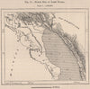


Lake Nyasa runs through every period of these maps of Malawi, from exploration and survey sheets to maps of colonial Nyasaland and the independent republic. Royal Geographical Society maps record the work of Stewart, Last, Rhoades and Phillips along the lakeshore, the Shire valley and the routes to Blantyre. Regional atlas maps set the country beside Mozambique, Zambia and Tanzania under their earlier colonial names, while later sheets show the republic and its economy. The prints add scenes of Mang'anja and Yao communities and a village beside the Shire.
EU orders up to €150 are sent VAT- and duty-paid — no additional taxes on arrival
Authenticity Guaranteed - We only sell original antique & vintage items
Can we help? Call us on +44-208-960-3476 • FAQs
All our products are exempt from US tariffs — no additional duties or taxes payable on arrival.


- Shop by Country
- Shop by Cartographer
- Shop Maps by Type
- Shop Prints by Subject