


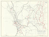


Manila's harbour, churches and commercial streets appear in these maps and prints across several phases of Philippine history. City plans, bay charts and regional atlas sheets are associated with Mallet, Weller, Rand McNally and the Admiralty, some showing the city only as an inset on island or East Asian maps, and water-supply plans from the Metropolitan Water District record its infrastructure. Military mapping covers the Spanish-American War and the Philippine campaign of the Second World War, setting the city among wider operations and air routes. The prints show the port, churches, bridges and streets, some published under the French name Manille.
EU orders up to €150 are sent VAT- and duty-paid — no additional taxes on arrival
Authenticity Guaranteed - We only sell original antique & vintage items
Can we help? Call us on +44-208-960-3476 • FAQs
All our products are exempt from US tariffs — no additional duties or taxes payable on arrival.


- Shop by Country
- Shop by Cartographer
- Shop Maps by Type
- Shop Prints by Subject