


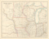

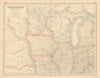


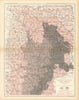

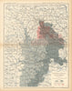





Great Lakes shipping, railways and coal give the maps of the Midwestern USA an economic as well as a geographical character. County-divided state sheets, Johnston's regional railway maps and atlas coverage of the Lake States sit beside survey maps recording the triangulation of Wisconsin and Minnesota, and United States Geological Survey sheets on the Western Interior coalfield, its production and markets. Broader maps reach across the plains towards the Rockies, reflecting publishers' differing ideas of the interior. Pictorial work by Boris Artzybasheff and Antonio Petruccelli shows lake shipping and railway traffic in a later idiom, and the prints include Catlin portraits of Great Lakes and midwestern Indigenous communities and an Ojibwe song recorded on birch bark.
EU orders up to €150 are sent VAT- and duty-paid — no additional taxes on arrival
Authenticity Guaranteed - We only sell original antique & vintage items
Can we help? Call us on +44-208-960-3476 • FAQs
All our products are exempt from US tariffs — no additional duties or taxes payable on arrival.


- Shop by Country
- Shop by Cartographer
- Shop Maps by Type
- Shop Prints by Subject