


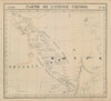

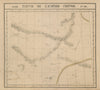

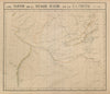

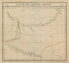

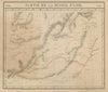

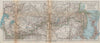


Routes across the Gobi link the camps, settlements and frontier regions in these maps of Mongolia. Earlier European sheets use broad names such as Western Tartary and Chinese Tartary, while later maps distinguish Inner and Outer Mongolia, the Siberian borderlands and neighbouring Manchuria. Geography derived from the Jesuits gives way to expedition maps associated with Ney Elias and Roy Chapman Andrews, and regional sheets follow Lake Baikal, Khovd, the approach to Urga and the passes into northern China. The prints show camps, travellers, clothing, religious sites and steppe animals, among them the Mongolian wild horse, and some comparative plates use the ethnographic categories of the nineteenth century.
EU orders up to €150 are sent VAT- and duty-paid — no additional taxes on arrival
Authenticity Guaranteed - We only sell original antique & vintage items
Can we help? Call us on +44-208-960-3476 • FAQs
All our products are exempt from US tariffs — no additional duties or taxes payable on arrival.


- Shop by Country
- Shop by Cartographer
- Shop Maps by Type
- Shop Prints by Subject