


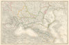


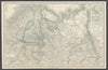


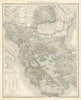

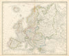


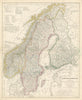



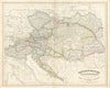


First published in Leipzig in 1814, Christian Gottfried Daniel Stein’s Neuer Atlas der ganzen Erde für die gebildeten Stände und für Schulen was intended for both educational use and the general public. The atlas combined finely engraved, hand-colored maps with extensive historical, political, and statistical tables. The first edition contained 14 maps, expanding in later editions to more than 28, including continents, individual countries, the United States, the Ottoman Empire, and detailed German regions. Its clear cartographic style, colorful boundaries, and shaded relief made it both visually appealing and informative. Issued in many editions into the late 19th century, it became a widely used geographic reference.
EU orders up to €150 are sent VAT- and duty-paid — no additional taxes on arrival
Authenticity Guaranteed - We only sell original antique & vintage items
Can we help? Call us on +44-208-960-3476 • FAQs
All our products are exempt from US tariffs — no additional duties or taxes payable on arrival.


- Shop by Country
- Shop by Cartographer
- Shop Maps by Type
- Shop Prints by Subject