


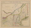

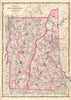


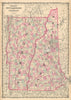


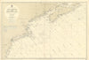


These antique maps follow New England's six northeastern states from colonial geography to the railway age, with the Atlantic seaboard, Long Island Sound and the Connecticut River recurring throughout. Early regional maps by Homann, Bellin and John Lodge precede atlas sheets by Johnson, Colton, Bartholomew and Walling and Gray, Coast Survey charts and triangulation diagrams map the shore, and railway maps link Boston with inland towns. The prints range from Boston's State House and Bunker Hill to Salem, Marblehead and the valleys of Vermont and Connecticut, with Harvard and Yale buildings, harbour scenes, village streets and illustrated accounts of colonial settlement.
EU orders up to €150 are sent VAT- and duty-paid — no additional taxes on arrival
Authenticity Guaranteed - We only sell original antique & vintage items
Can we help? Call us on +44-208-960-3476 • FAQs
All our products are exempt from US tariffs — no additional duties or taxes payable on arrival.


- Shop by Country
- Shop by Cartographer
- Shop Maps by Type
- Shop Prints by Subject