


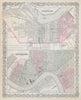


The Mississippi's bend and the streets behind the levee anchor these maps of New Orleans, from Bellin's eighteenth-century plan to twentieth-century atlas sheets. Some show the city alone, others pair it with Louisville or set it within Louisiana and the lower river, often in detailed insets. The prints turn to Canal Street, Jackson Square, the cathedral and the riverfront, with cotton steamers linking the port to its hinterland, while Mardi Gras processions and election scenes capture public life. Civil War illustrations and a map of the 1815 battle at Chalmette bring in military history, and levee works, breaches and river diagrams show the river's constant presence.
EU orders up to €150 are sent VAT- and duty-paid — no additional taxes on arrival
Authenticity Guaranteed - We only sell original antique & vintage items
Can we help? Call us on +44-208-960-3476 • FAQs
All our products are exempt from US tariffs — no additional duties or taxes payable on arrival.


- Shop by Country
- Shop by Cartographer
- Shop Maps by Type
- Shop Prints by Subject