


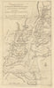


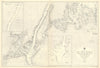


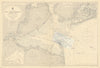


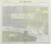







Explore antique maps and prints of New York City, from early harbour and city plans to Manhattan and outer-borough street maps, Sanborn insurance sheets, coastal surveys and aerial views. Subway material includes George Salomon, Massimo Vignelli and New York City Transit Authority diagrams. Other makers include SDUK, Johnson, Letts, Baedeker, Rand McNally, Bollmann, the U.S. Coast Survey and Admiralty, alongside views of streets, landmarks, bridges and waterfronts.
EU orders up to €150 are sent VAT- and duty-paid — no additional taxes on arrival
Authenticity Guaranteed - We only sell original antique & vintage items
Can we help? Call us on +44-208-960-3476 • FAQs
All our products are exempt from US tariffs — no additional duties or taxes payable on arrival.


- Shop by Country
- Shop by Cartographer
- Shop Maps by Type
- Shop Prints by Subject