
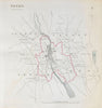


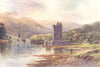


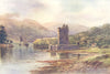


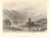


Newry is represented by Robert Dawson’s 1832 Reform Act plan and Taylor and Skinner road strips linking the town with Dublin, Strangford, Markethill, Carlingford, Ballybay and Donaghadee. John Cary and John Bartholomew maps cover Newry, Carlingford Lough and the Mourne Mountains, while William Henry Bartlett and Alexander Williams views depict Narrow Water Castle on the Newry River and lough.
EU orders up to €150 are sent VAT- and duty-paid — no additional taxes on arrival
Authenticity Guaranteed - We only sell original antique & vintage items
Can we help? Call us on +44-208-960-3476 • FAQs
All our products are exempt from US tariffs — no additional duties or taxes payable on arrival.


- Shop by Country
- Shop by Cartographer
- Shop Maps by Type
- Shop Prints by Subject