


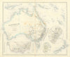


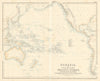

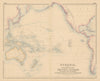


Birds of paradise, Captain Cook and the steamship routes of the Pacific all find a place in these maps of Oceania, a region far wider than Australia alone. New Zealand, New Guinea, the Pacific islands and the East Indies are grouped in different ways by successive publishers, with Melanesia, Micronesia and Polynesia, colonial possessions, explorers' routes and charts of Australasian ports. Commercial maps follow telegraph cables, mineral districts and farming, and Vandermaelen, Levasseur, Johnston and later pictorial mapmakers each treat the region in their own way. Prints add natural history and exploration, in material from the late eighteenth to the twentieth century.
EU orders up to €150 are sent VAT- and duty-paid — no additional taxes on arrival
Authenticity Guaranteed - We only sell original antique & vintage items
Can we help? Call us on +44-208-960-3476 • FAQs
All our products are exempt from US tariffs — no additional duties or taxes payable on arrival.


- Shop by Country
- Shop by Cartographer
- Shop Maps by Type
- Shop Prints by Subject