
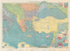


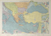


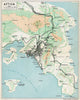


Piraeus was the harbour that linked Athens with the eastern Mediterranean, and its maps run from sea charts to the plans of a growing port city. Nautical plans by Roux and Gauttier use the older name Porto Leone or Port Lion, while later street and guidebook maps relate the port to the capital and the Attic coast. Regional sheets reach Salamis, Aegina and the Saronic Gulf, the approaches used by shipping. The prints show diplomatic arrivals, naval activity and temporary military camps, moments when the port served as Greece's point of contact with foreign powers.
EU orders up to €150 are sent VAT- and duty-paid — no additional taxes on arrival
Authenticity Guaranteed - We only sell original antique & vintage items
Can we help? Call us on +44-208-960-3476 • FAQs
All our products are exempt from US tariffs — no additional duties or taxes payable on arrival.


- Shop by Country
- Shop by Cartographer
- Shop Maps by Type
- Shop Prints by Subject