


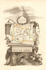


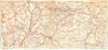




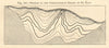





Volcanic ridges, spa valleys and the streets of Clermont-Ferrand fill these antique maps and prints of the Puy-de-Dôme, at the heart of the Auvergne. Departmental sheets by Levasseur, Perrot, Tardieu and Vuillemin set out the towns and resources, guidebook maps focus on the Chaîne des Puys, Mont-Dore, La Bourboule and the Sancy, and geological sections around Volvic and Saint-Éloy-les-Mines show the rocks and the mines, while Clermont and Montferrand have city plans as well as views. The prints range from broad mountain silhouettes to Royat's valley, the river at Thiers and architectural details at Saint-Nectaire and Notre-Dame-du-Port, with the summit observatory, Roman remains, waterfalls and thermal resorts.
EU orders up to €150 are sent VAT- and duty-paid — no additional taxes on arrival
Authenticity Guaranteed - We only sell original antique & vintage items
Can we help? Call us on +44-208-960-3476 • FAQs
All our products are exempt from US tariffs — no additional duties or taxes payable on arrival.


- Shop by Country
- Shop by Cartographer
- Shop Maps by Type
- Shop Prints by Subject