


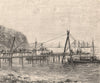


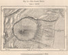

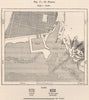


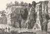


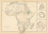

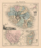


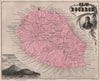


Bourbon and Mascareigne, the island's older names, recur on these maps of Réunion, from Mallet, Bellin and Schley to nineteenth-century mapping by Weller and Vuillemin that often sets it beside Mauritius, Madagascar and other Indian Ocean islands. More focused maps identify Saint-Denis, the volcanic interior and the island's economic resources. The prints move between the waterfront and the steep country inland, showing Saint-Pierre, the Grand Brûlé, ravines, waterfalls and the cirques, with eruptions and cyclones among the subjects, while Saint-Denis contributes its cathedral, governor's residence and marine barracks.
EU orders up to €150 are sent VAT- and duty-paid — no additional taxes on arrival
Authenticity Guaranteed - We only sell original antique & vintage items
Can we help? Call us on +44-208-960-3476 • FAQs
All our products are exempt from US tariffs — no additional duties or taxes payable on arrival.


- Shop by Country
- Shop by Cartographer
- Shop Maps by Type
- Shop Prints by Subject