San Diego
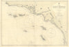
Explore maps and prints of San Diego and its coast, led by British Admiralty sea charts and U.S. Coast Survey and USCGS sect...
Read MoreExplore maps and prints of San Diego and its coast, led by British Admiralty sea charts and U.S. Coast Survey and USCGS sectional surveys. Coverage extends from San Diego Bay and the Southern California Bight north toward Los Angeles, Point Sal and Cape Mendocino. Vandermaelen’s 1827 Atlas Universel sheet, Reclus’s city plan and Stoddard’s Coronado views complete the collection.
Explore maps and prints of San Diego and its coast, led by British Admiralty sea charts and U.S. Coast Survey and USCGS sectional surveys. Coverage extends from San Diego Bay and the Southern California Bight north toward Los Angeles, Point Sal and Cape Mendocino. Vandermaelen’s 1827 Atlas Universel sheet, Reclus’s city plan and Stoddard’s Coronado views complete the collection.