
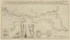


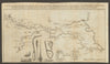


Selby's great abbey church rises above the Ouse in the Vale of York, and the prints study it closely, from a south-east view and a pier of the nave in 1815 to an aisle bay of 1868 and the east window of 1877. A view of the market place around 1900 turns to the town. The maps start with a plan for an intended navigable canal from Leeds to Selby, published in the Gentleman's Magazine in 1774, which would have joined the town to the Aire and Calder. Jefferys's map of 1772 places it among York, Pontefract and Tadcaster, the Ordnance Survey of 1858 covers the Vale of York, and a geological sheet of 1959 maps the ground around the town and the river.
EU orders up to €150 are sent VAT- and duty-paid — no additional taxes on arrival
Authenticity Guaranteed - We only sell original antique & vintage items
Can we help? Call us on +44-208-960-3476 • FAQs
All our products are exempt from US tariffs — no additional duties or taxes payable on arrival.


- Shop by Country
- Shop by Cartographer
- Shop Maps by Type
- Shop Prints by Subject