


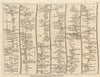

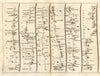



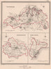


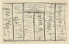


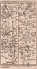


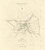


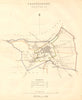


Shaftesbury stands on its ridge above the Blackmore Vale, and the coaching roads that climbed to this hilltop town in northern Dorset run through its maps. Ogilby's road from Andover through Salisbury and Shaftesbury to Sherborne and Crewkerne, published in 1675, was redrawn by Senex and Gardner in 1719, and Owen and Bowen and Paterson carried the route on through Sherborne to Yeovil. Dawson's plans of 1832 and 1837 show the town and its parliamentary borough reaching out towards Hartgrove, and the Boundary Commission mapped it again in 1868. The prints include an antiquarian plate of 1817 with the abbey, a Blackmore Vale illustration of 1906 for Jude the Obscure, Eve Kirk's St James of 1949 and the town's coat of arms.
EU orders up to €150 are sent VAT- and duty-paid — no additional taxes on arrival
Authenticity Guaranteed - We only sell original antique & vintage items
Can we help? Call us on +44-208-960-3476 • FAQs
All our products are exempt from US tariffs — no additional duties or taxes payable on arrival.


- Shop by Country
- Shop by Cartographer
- Shop Maps by Type
- Shop Prints by Subject