
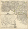


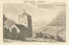

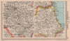

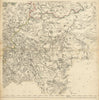


Sheffield, Rotherham, Barnsley and Doncaster anchor the maps of South Yorkshire, a modern county name laid over country that older mapmakers divided between the ridings and neighbouring shires. Thomas Jefferys's survey of 1772 maps the environs of those towns with Bawtry, Tickhill and Thorne, and a companion sheet covers Penistone, Holmfirth and Huddersfield beside a plan of Leeds. Cary's sheet of 1832 carries the West Riding into north-west Lincolnshire, north Nottinghamshire and north-east Derbyshire, while Cole and Roper's map of about 1835 takes in parts of the East and West Ridings. Swanston's railway map of 1860 traces the routes of the industrial region, Bartholomew's sheet of 1949 pairs it with Tyneside, and an 1814 view from the Gentleman's Magazine records Beauchief Abbey, then counted in Derbyshire and now within Sheffield.
EU orders up to €150 are sent VAT- and duty-paid — no additional taxes on arrival
Authenticity Guaranteed - We only sell original antique & vintage items
Can we help? Call us on +44-208-960-3476 • FAQs
All our products are exempt from US tariffs — no additional duties or taxes payable on arrival.


- Shop by Country
- Shop by Cartographer
- Shop Maps by Type
- Shop Prints by Subject