


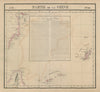


Antique maps and prints of Taiwan, often named Formosa on earlier sheets, include island maps, coastal charts, harbour plans and views of local life. Bellin’s eighteenth-century mapping, Van Keulen’s Penghu chart, Dennys’s treaty-port maps and later Admiralty surveys sit alongside tourist maps and railway-era plans. Coverage includes Taipei, Keelung, Tainan, Kaohsiung and Anping’s Fort Zeelandia, with maps recording Taiwan’s relationship to neighbouring coasts.
EU orders up to €150 are sent VAT- and duty-paid — no additional taxes on arrival
Authenticity Guaranteed - We only sell original antique & vintage items
Can we help? Call us on +44-208-960-3476 • FAQs
All our products are exempt from US tariffs — no additional duties or taxes payable on arrival.


- Shop by Country
- Shop by Cartographer
- Shop Maps by Type
- Shop Prints by Subject