
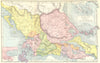

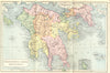





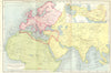


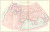


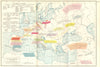


The ancient Mediterranean, from Greek city plans to the campaigns of the Punic Wars, is laid out for readers of the classics in these maps from The Atlas of Ancient & Classical Geography, published in 1908 in the Everyman tradition. Edited by Ernest Rhys and published by J. M. Dent in London with E. P. Dutton in New York, the atlas gave students a compact reference to antiquity. The Peloponnese, central Greece, southern Italy and Sicily appear with plans of Athens and Syracuse, wider sheets place Carthage and Rome, and a reconstruction of Ptolemy's world shows ancient geographical knowledge itself. They are twentieth-century maps of the ancient world, with Latin titles and historical territorial names.
EU orders up to €150 are sent VAT- and duty-paid — no additional taxes on arrival
Authenticity Guaranteed - We only sell original antique & vintage items
Can we help? Call us on +44-208-960-3476 • FAQs
All our products are exempt from US tariffs — no additional duties or taxes payable on arrival.


- Shop by Country
- Shop by Cartographer
- Shop Maps by Type
- Shop Prints by Subject