


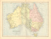


Ancient Germania, New York in 1878, the railways of Mesopotamia and the celestial planispheres all appear in these antique maps from The Library Atlas, published by William Collins, Sons & company, Limited in London between 1876 and 1878. The atlas carried descriptive letterpress by James Bryce on modern geography, William F. Collier on historical geography and Leonhard Schmitz on classical geography. Its plates take in Rhaetia and Noricum, Pennsylvania, New Jersey, Delaware and Maryland, Queensland and South Australia, Turkey, Syria and Cyprus, Southeast Asia and the British colonies in Africa, with ancient Greece shown alongside an inset of Athens. Bartholomew maps record battles in the British Isles and Napoleonic Europe, nineteenth-century Canada and the provinces of New Zealand.
EU orders up to €150 are sent VAT- and duty-paid — no additional taxes on arrival
Authenticity Guaranteed - We only sell original antique & vintage items
Can we help? Call us on +44-208-960-3476 • FAQs
All our products are exempt from US tariffs — no additional duties or taxes payable on arrival.


- Shop by Country
- Shop by Cartographer
- Shop Maps by Type
- Shop Prints by Subject