


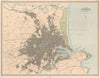

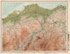

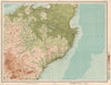

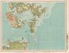

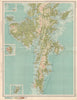

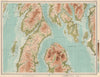

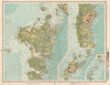

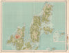

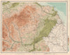

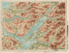

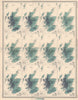

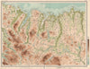


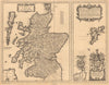

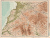

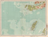
The Survey Atlas of Scotland, designed and edited by J. G. Bartholomew and published by the Edinburgh Geographical Institute, was first issued in 1895 and stands as one of the most ambitious and detailed national atlases of its time. Comprising a series of finely engraved and coloured plates, it provided a comprehensive cartographic portrait of Scotland, covering its topography, geology, hydrography, climate, political divisions, and economic and demographic features. Produced under the patronage of the Royal Geographical Society, the atlas was both a scientific and artistic achievement, combining Bartholomew’s high standards of geographic accuracy with elegant design. A second, revised edition was published in 1912, incorporating updated survey data and reflecting new developments in transport and infrastructure. Together, the two editions offer a rich visual and statistical record of Scotland in the late 19th and early 20th centuries, and represent the pinnacle of Bartholomew’s national atlas production.
EU orders up to €150 are sent VAT- and duty-paid — no additional taxes on arrival
Authenticity Guaranteed - We only sell original antique & vintage items
Can we help? Call us on +44-208-960-3476 • FAQs
All our products are exempt from US tariffs — no additional duties or taxes payable on arrival.
- Shop by Country
- Shop by Cartographer
- Shop Maps by Type
- Shop Prints by Subject