


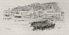


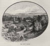


Historic maps and views of Wellington, New Zealand, including nineteenth- and twentieth-century city plans by Bartholomew and Johnston, atlas sheets with Wellington insets, and harbour and waterfront scenes from the Picturesque Atlas of Australasia. Coverage includes Queen’s Wharf, the Post Office, Te Aro foreshore, Thorndon, the Hutt Valley and nearby settlements, alongside panoramic city views and comparative sheets of New Zealand’s principal cities.
EU orders up to €150 are sent VAT- and duty-paid — no additional taxes on arrival
Authenticity Guaranteed - We only sell original antique & vintage items
Can we help? Call us on +44-208-960-3476 • FAQs
All our products are exempt from US tariffs — no additional duties or taxes payable on arrival.


- Shop by Country
- Shop by Cartographer
- Shop Maps by Type
- Shop Prints by Subject