
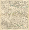


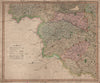


Leeds, Bradford, Halifax, Wakefield and Huddersfield are drawn together with the Pennine uplands in these antique maps of West Yorkshire, which reach well beyond today's metropolitan county. Jefferys's eighteenth-century sheets connect the towns with neighbouring districts, and Teesdale and later county publishers divide Yorkshire into regional sections. Parliamentary maps record the constituencies around the industrial towns and the western parts of the historic riding, while geological sheets by Reynolds and Stanford link the district with Lancashire across the Pennines. Plans of Leeds and Pontefract give a closer view, and some sheets reach towards Sheffield, Skipton and the Dales.
EU orders up to €150 are sent VAT- and duty-paid — no additional taxes on arrival
Authenticity Guaranteed - We only sell original antique & vintage items
Can we help? Call us on +44-208-960-3476 • FAQs
All our products are exempt from US tariffs — no additional duties or taxes payable on arrival.


- Shop by Country
- Shop by Cartographer
- Shop Maps by Type
- Shop Prints by Subject