


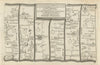
Whitchurch is a market town on the northern edge of Shropshire, close to the Cheshire border, on a road network that reaches back to the Roman settlement of Mediolanum beneath it. The road maps show it as a stopping place on the way to Chester: Ogilby's survey of 1675 follows the long road north from Ludlow through Shrewsbury, Gardner and Kitchin published later versions of the route, and Paterson's strips of 1785 and 1803 link the town with Newport and Malpas. The Ordnance Survey sheet of 1833 sets it in the plain of Shropshire, Cheshire and Staffordshire. Two prints complete the picture: Thomas Lockwood's design for the town hall and markets of 1873, and Combermere Abbey nearby.
EU orders up to €150 are sent VAT- and duty-paid — no additional taxes on arrival
Authenticity Guaranteed - We only sell original antique & vintage items
Can we help? Call us on +44-208-960-3476 • FAQs
All our products are exempt from US tariffs — no additional duties or taxes payable on arrival.


- Shop by Country
- Shop by Cartographer
- Shop Maps by Type
- Shop Prints by Subject