


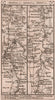


Wrotham sits beneath the chalk ridge of the North Downs on the old roads between London, Maidstone and east Kent, which is why the great road books map it again and again. The archbishops of Canterbury once had a palace at the heart of the village. Gardner and Senex in 1719, and Kitchin in 1767, follow the road from London through Maidstone to Ashford and Hythe, and Owen and Bowen's map of 1753 records the approach out of south-east London. Paterson's strip maps of 1785 and 1803 run east from Wrotham through Maidstone to Ashford, and west from Maidstone through Wrotham and Sevenoaks to Godstone. Cary's sheets of 1786 and 1811 show the village among Stansted, Ightham, Ridley and Kingsdown.
EU orders up to €150 are sent VAT- and duty-paid — no additional taxes on arrival
Authenticity Guaranteed - We only sell original antique & vintage items
Can we help? Call us on +44-208-960-3476 • FAQs
All our products are exempt from US tariffs — no additional duties or taxes payable on arrival.


- Shop by Country
- Shop by Cartographer
- Shop Maps by Type
- Shop Prints by Subject