


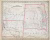




Yellowstone's geysers, terraces and deep river canyons make these prints of Wyoming especially vivid, from illustrated accounts of the Washburn, Langford and Doane expedition to later photographs and colour plates of Old Faithful, the Mammoth Hot Springs and the falls of the Yellowstone. The maps range from Johnson and Colton atlas sheets to county, railway and highway maps. Clarence King's survey covers the Rocky Mountains and the Green River Basin in topographical and geological detail, and Native American land-cession maps mark tribal territories and the Wind River Reservation. Views around Laramie, the Tetons and the Union Pacific railway take the record beyond the national park.
EU orders up to €150 are sent VAT- and duty-paid — no additional taxes on arrival
Authenticity Guaranteed - We only sell original antique & vintage items
Can we help? Call us on +44-208-960-3476 • FAQs
All our products are exempt from US tariffs — no additional duties or taxes payable on arrival.


- Shop by Country
- Shop by Cartographer
- Shop Maps by Type
- Shop Prints by Subject