


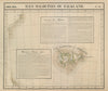


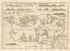


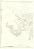


Harbour surveys, naval battles and competing territorial claims run through the printed history of the Falkland Islands. The maps begin with Lodge's early map of the islands and include Vandermaelen's regional sheet, charts associated with FitzRoy and wider mapping of Patagonia and the South Atlantic. Period news reports deal with Port Egmont, Port Louis, settlement and possession, while the prints add shipping and natural history. Battle diagrams trace the naval action of December 1914, and later Admiralty charts and mine-clearance maps reach the Falklands War, among them charts catalogued as used aboard HMS Glamorgan in 1982.
EU orders up to €150 are sent VAT- and duty-paid — no additional taxes on arrival
Authenticity Guaranteed - We only sell original antique & vintage items
Can we help? Call us on +44-208-960-3476 • FAQs
All our products are exempt from US tariffs — no additional duties or taxes payable on arrival.


- Shop by Country
- Shop by Cartographer
- Shop Maps by Type
- Shop Prints by Subject