


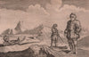


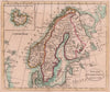


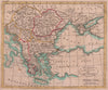
John Payne's geographical reference work captures Europe on the eve of the nineteenth century, with France divided into departments and Poland partitioned. The maps from Payne's Geography, dated 1798, also show Switzerland by cantons, northern and southern Russia, Italy, Iberia, Scandinavia and the Netherlands, and a world chart on Mercator's projection marks Cook's route. The book's prints add the Winter Palace at St Petersburg, the destruction of the Bastille and Sámi dress and travel under the original Lapland caption.
EU orders up to €150 are sent VAT- and duty-paid — no additional taxes on arrival
Authenticity Guaranteed - We only sell original antique & vintage items
Can we help? Call us on +44-208-960-3476 • FAQs
All our products are exempt from US tariffs — no additional duties or taxes payable on arrival.


- Shop by Country
- Shop by Cartographer
- Shop Maps by Type
- Shop Prints by Subject