Hide out of stock items


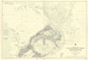
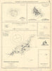
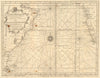
![Antique sea 'Chart of the Islands of Cape Verd' [Verde]. MOUNT & PAGE 1758 map](http://www.antiquemapsandprints.com/cdn/shop/files/P-8-005244a.jpg?v=1758196908&width=3000)
![Antique sea 'Chart of the Islands of Cape Verd' [Verde]. MOUNT & PAGE 1758 map](http://www.antiquemapsandprints.com/cdn/shop/files/P-8-005244a_100x100.jpg?v=1758196908)

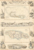

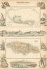


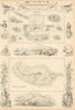


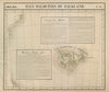


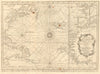


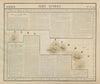


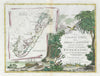
Browse our stock of antique maps and prints of the Atlantic Ocean, and the islands and archipelagos of the Atlantic, including Bermuda, the Falkland Islands, Ascension Island, the Azores and the Cape Verde Islands. Many of our old maps of the North Atlantic and South Atlantic show shipping routes, telegraph cables, currents and the Gulf Stream, ocean depths, and World War 2 Atlantic convoys & ocean warfare. For the other Macronesian archipelagos of Madeira and the Canary Islands, see the Spain and Portugal categories